The drizzle started up again, but I continued to lean on the hood of my rental.
In the last installment, I neglected to mention that the actor playing Ollie was in fact the best basketball player of the Hoosiers cast and a star on his local Indiana team, while the actor playing Jimmy Chitwood, the best player of the fictional high school, had failed to make the team three years running. If you’re a Hoosiers fan, this sort of detail is important.
My current predicament couldn’t be fixed with a Hoosiers. Will power and luck wouldn’t get me off this summit. I’d brought myself here through my own decisions. Reasonable decisions, really. Well, reasonable for me. I don’t think of myself as a risktaker, but a scrutiny of those decisions would reveal, again, that I’m not much for planning. There are times when, after the fact, even I’m a bit aghast at my casual assumptions: not realizing snow doesn’t melt by April, not wondering if the second highest pass in California might have a steep slope or two. Or three.
But here I was. All because Sonora Pass tasked me. At least I wasn’t chasing round Perdition’s flames.
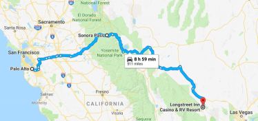 Summer 2018: I was scheduled into a two week class in Colorado Springs just four days before the class started. It took me less than a minute to decide on a road trip, and thirty seconds longer to plan Attempt #3.
After the long-awaited summit, I’d take remote Nevada state highways (the best kind!) 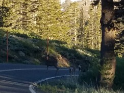 and stop at a neat little hotel near Death Valley, out in the middle of nowhere. It’d be great.
And it was great, once I got started. My initial Hertz location was out of rentals, and while leaving the Bay Area at 2:45 escapes the worst home traffic, it put me in Friday afternoon traffic everywhere else. Progress slowed, and I didn’t hit Sonora 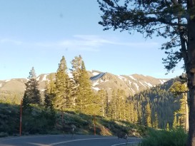 itself until 7:00 in the evening.
But Sonora Pass! Made it! Huzzah! I recommend the spectacular view. In a car with automatic transmission. I reached the pass at 7:33 in the evening and what should I see but three deer! Two of them passed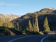 right away, but the third one was nervous–probably of me–so I just waited patiently for him(her?) to get up the nerve.
Milestone achieved.
I stopped for some drinks at the Bridgeport Shell, but gas was $5/gallon. The prices went up from there through Mono Lake and Lee Vining. My rental was telling me I had 175 more miles. That’s three hours. I hadn’t seen any “last gas” signs, right? So I figured I’d fill up when I got into Nevada, away from California’s gas taxes.
Turning onto 120 East, I was thrilled by the utter blackness. Night-driving on interstates is pretty tedious, but driving on dark roads with only headlights beaming out–well, okay, I’m crazy. But when I took these pictures, I was enjoying the hell out of my drive.
Until.
The thought occurred to me that all those “last gas” signs showed up on US interstates, not state two-lanes with deliciously gloomy lighting. But that was ok. I mean, surely I wasn’t going to go 175 miles without seeing a gas station, right?
And then the next thought occurred to me, the thought about it now being 9:45 at night, in a very remote location, with very few turnoffs, and that perhaps–just perhaps–there might not be any open gas stations?
 Whoa.
Whoa.
Despite thirty years of driving to the fuel needle overlapping the E-line, the only time I’d ever run out of gas was about twenty-five years ago in my sister’s minivan, whose “low fuel” light wasn’t kidding around. By this point, my car actually stopping because the tank was empty simply wasn’t an event I believed in. Other people, sure. But not me.
So I’m proud that I began worrying about gas stations with about 125 miles left in the tank. It shows I’m not entirely incapable of acquiring wisdom.
But acquiring wisdom enough to worry wasn’t the same as actually turning around to pay $6 for gas and add four hours to my trip. Worrying the gas stations were all closed is a far cry from actually believing the state of Nevada wouldn’t provide an open gas  station for hundreds of miles. And just like, that the fast fact that the federal government owns 84% of Nevada flashed through my memory, and I started carefully checking Google Maps for open gas stations.
The only good news to be had was that I was in fact capable of using Google Maps. The last time through the Death Valley area, my cell phone had been a paper weight. Sprint has really improved its coverage, although it cut out now and then. The coverage only to allow me to learn that the only three gas stations within 90 miles, in all directions, were all closed. I called AAA to ask if they had any better info, but every so often the coverage cut out. This forced me to redial, which I did through the car’s Bluetooth connection. But I always had to start off by looking down at my phone , and all of this meant I wasn’t precisely looking at the road every single second which really shouldn’t have been a problem because there was no one else on the road except
“OH SHIT!”….and I braked, hard, felt the car fishtail, took my foot off as I realized there was no way the car would stop before reaching the two huge, brown, meandering creatures plodding down the middle of the road barely visible through the mist right smack in my path, saw the small gap between them, floored it, sucked in my breath, hoped the car would do the same, and scooted through two cows, and I know they were cows because the left one’s head was just inches from my window, which is how I learned that “Open Range” signs aren’t just for daylight hours. Don’t cows sleep?
Miraculously, the car made it through the cow gap, and I immediately stopped, took a deep breath and said, “Eastern 401.”
The drizzle had soaked my hair through, and my jeans were getting damp, so I reluctantly climbed back into the car on the passenger side. Missing the cows was the mother of all Garfields, putting all other inconveniences into profound perspective.
The Eastern Everglades crash of 1972 is a much-analyzed crash in which a three-man crew flew a perfectly functioning airplane into the Florida Everglades because they accidentally turned off the autopilot while trying to fix a broken landing gear light. There’s a famous re-enactment training video that I vividly remember watching it in the 90s on some PBS documentary about air safety, crouching behind my couch in horror the whole time. (The co-pilot’s last recorded words are “wait, we’re still at 2000 feet, right?” when they were 100 feet above the swamp.)
I do not like to fly. Observant readers might note that not only is flying is much much safer than driving but that flying might in particular be much much much much safer than my driving, and they would be wrong on the second, but understandably so. My driving is just the ordinary amount less safe. Still, our fears don’t always align with logic, and I would rather be stuck on a desert summit than sitting on a plane hoping my pilot remembered he’d turned the auto-pilot off.
It had been years since I’d thought of my first invocation of the Eastern rule.
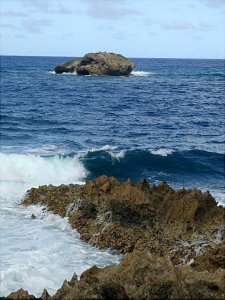 May of 2000: My first solo vacation since college. I vowed to do more than just sit on my condo’s beach. I would explore Maui in depth with my just purchased, ridiculously expensive, digital camera.
So day one, I woke up and drove out to Lipoa Point, a famous surfer’s site accessible through privately owned land on a dirt road. After parking off-track, I pushed through some brush and came upon a spectacular cliff with the surf crashing below. Engrossed in using my wowbang telephoto lens, I wedged the camera case between my feet and eventually a strong burst of wind blew it over the cliff.
Damn. It was just a cheap camera case, but I’m neglectful on replacing lost items, and my brand new digital wonder needed protection. The sun was low in the sky but it was May, so days were longer, and I meandered over to the left until I found sketchy dirt path headed down. A few surfers packing their stuff away looked at me curiously.
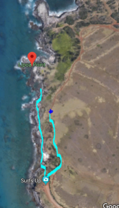 Once at the bottom of the now isolated beach, I walked over the rocks and sand, taking a few pictures before tucking my camera into my fanny pack and looking in earnest for my camera case–a stupid, plastic thing with no clips or shoulder straps, which is why it blew away in the first place.
(Here’s my route I was taking pictures to the left of the clump of green when the case blew off the cliff. )
Looked in the water, looked in the trees growing up the sand cliffs, looked under rocks–no good. How could I protect my camera without this case? But finally I gave up and headed back. The sun was getting a lot lower in the sky, although I still had plenty of time to climb back up the path.
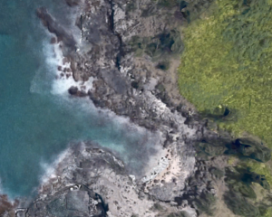 Except the charming little tidal inlet I’d passed just 20 minutes earlier was now a deep pool of choppy waves, crashing all the way to the cliff. I was on one side of the pool. The path back up the cliff was on the other. High tide.
Well, crap.


This reminds me of the bit in Desert Solitaire where the guy has been hiking for a day and thinks that a quick dip in a nearby pond would be just the ticket, so he dives in, and then realizes that the lip of the pond is about two inches higher than he can reach while he’s in the water.Report
hahahahah!
Yeah, I’m….not much of a planner.Report